
The Five Year Voyage is a race against time and tide across the mouth of the Amazon for Stephen Ladd in his 21ft Herreshoff Sea Pear ketch. Introduced by Tom Cunliffe

Stephen Ladd is a city planner from the US who opted for a better life. Not being inclined to luxury, his first book goes under the title Three Years in a Twelve-foot Boat. But here we have an account from his second book The Five-year Voyage which struck a chord with me personally.
Many years ago I sailed from Rio to the Caribbean in a 32ft gaff cutter whose engine had been defunct for over a year. Running up the north coast of South America I passed the mouth of the Amazon a substantial distance offshore and was astonished to see brown river water curdling the tropical blue. I also ran into a depressing 2-knot counter-current where, according to the Admiralty Sailing Directions, I should have been whisked along by the same velocity going my way.
I discovered in Stephen’s book that his extraordinary voyage through the rivers and shorelines of South America had found him alone near the mouth of that great waterway facing the task of working his way through shoals, tides and barely charted waters. His wife and partner in the venture, Ginny, had recently given birth to a son and gone back to the US to let the lad have a fair chance in life. Stephen’s job was to bring the boat home and join them…
 Extract from The Five-year Voyage
 Extract from The Five-year Voyage
With my wife and baby gone Thurston actually seemed roomy, but this was slim compensation. My job now was to rejoin them as quickly and as safely as possible, so I finished the boat work and mapped the Amazon delta.
The delta extends 170 nautical miles from north-west to south-east. In this maze of islands, channels, and sandbanks nothing is much above or below sea level. Fifty miles out to sea the water is still only 10m deep! The large tidal range creates powerful currents, the floods just as strong as the ebbs. Belem is on the Para River: a short, wide collector of several rivers. Its mouth is 70 miles north-east of Belem. Tidewater back-channels connect it to the Amazon, which lies to the north-west. Thus the Para and Amazon have separate mouths but share one delta.
My initial plan was to travel inland via the back-channels then exit via the Amazon’s northernmost mouth. That way I would stay in rivers as long as possible and delay entering the Atlantic. But I changed that upon talking with my Russian friends, Anton and Julia.
Their boat was the Scalawag, a 37ft Irwin cutter, built in the US in 1976. They had already tried twice to exit the Para mouth. Both times they were defeated by engine problems and strong currents. The second time they were cleaned out by pirates as well. “They came aboard at night, held us up at gunpoint, and took everything, even our clothes!” they said. But they were ready to try again, this time at the half moon, when the tides are in neap and the currents are slower.
I liked the idea of catching the next neap, just three days away, but the dangerous segment from the last anchorage out to the 10m depth contour was too long to sail between sleeps, so I asked if they could tow me. They agreed, and on 6 August the Scalawag towed Thurston out into the Para River.
We were still within sight of Belem when the Scalawag lurched to a halt. The chart showed a depth of 2m yet we had run aground. The tide was falling. By noon she was high and dry on a ribbon of sand, near where pirates had attacked them before. Anxious to free ourselves promptly upon the rising tide we set out anchors and dug a pit to facilitate turning the keel. As the water came up Anton and I winched her bow around to face deep water. Finally she lifted and we motored off.
Just offshore from where solid land ended we waited for the tide to change again. A three-knot current pulled the anchor chain straight as a rod. During the wave-tossed night a new sound brought us up deck: a fishing net had gotten draped over the chain! A boat came close. Grumbling, mumbling men freed it in the black night. We went back to bed.

Thurston is a modified 21ft Herreshoff Sea Pear cat ketch with fibreglass hull and watertight wooden cabin. Draught is just 7in
The next day favourable currents helped us sail past the critical zone, where navigable channels alternate with shoals where surf breaks at low tide. When we reached the 10m contour we turned north-west toward French Guiana. The sea was too rough for the Scalawag and Thurston to separate so we continued together through a third night. I had slept during the day, so at 9pm I took the helm. I sailed Scalawag through fleet after fleet of fishing boats, knowing each had a net several kilometres long that could catch on a hull appendage. Whenever I thought I had passed the last boat more lights appeared on the horizon. Innumerable small wooden vessels were working the shallows 50 miles from land, each a threatening point of light.

Thurston’s lightweight cat rig can be stepped and unstepped single-handed
At 0300 Julia came on deck. She and Anton often quarrelled. I’d never had a conversation with her because she spoke nothing but Russian. The wind and sea were high. To make sure she understood the danger I pointed to one light after another, each time saying ‘Fishing boat,’ until I had completed a circle. “Fishing boat, fishing boat, fishing boat! Too many fishing boats!” I had dowsed the jib to slow the boat down. Julia indicated we should put it back up. We got Anton up to referee. They started bickering. Suddenly Scalawag went dead in the water. She had snagged a net.
A long net is the ultimate sea anchor. It doesn’t move an inch relative to the water, whereas Scalawag and Thurston wanted to be blown downwind. The net slipped free of Scalawag’s hull only to drape over the tow line connecting the two boats. Now the net was upwind and the boats were downwind, side-by-side, draping over the tow rope. I swam to Thurston and untied the tow line, hoping Anton could pull it through from his end, but it was stuck.

photographed by Ginny from a bridge, Stephen and Thurston struggle against rapids
Among much confusion of lines I sat on Thurston’s bow and pulled hand-over-hand until I reached the net. The strain had caused it to snarl around the tow line. The best I could do was cut the line on either side of the snarl. It was my main anchor rode, detached from my anchor for towing purposes. I saved the two halves and would rejoin them later.
By this time it was nearly dawn. The wind had dropped. It was a good time to separate. I got my things and departed, anxious to preclude further calamities. By the time I got Thurston in order and raised her masts Scalawag had disappeared over the horizon.
The downside to having exited via the Para mouth was that I now had 250 miles to travel before I would find safe refuge, much further than any previous passage. I would spend three nights adrift, difficult in Thurston because she rocks so violently, and I was already short on sleep.
The wind soon built to 20 knots from the east, an ideal angle. I flew all day, deeply reefed, the waves hissing as they slowly overtook me. At sunset I dropped my sea anchor, a cloth parachute attached to the bow by a stout line. The GPS now showed that a current was pulling me west at five knots. This speed and direction varied during the night as the tidal waters swirled. The wind never let up.

Boat transport, Amazonian style.
Thurston oscillated once per second, sometimes to such an angle that her gunwales dipped underwater, obliging me to leave the cockpit drain open. Lying longitudinally was impossible so I curled up perpendicular to the keel in a foetal position. Better to be rocked in a berserk rocking chair than to be rolled back and forth like a log in the surf!
The next day I averaged six knots through alternating tracts of green ocean water and brown river water. Still 50 miles offshore, I steered north-west by the compass. Suddenly the GPS said I was going east though I was still headed north-west. Could a current possibly be so strong as to reverse me like that? No matter how I steered the GPS still said I was speeding east.
A half hour later this anomaly disappeared and I was going north-west again. There was never any sense of acceleration or deceleration, but there never is in an ocean current. Had the GPS allowed me to perceive a freak super-current, or had it malfunctioned for a half hour?
On the second night the sea anchor dragged me over a shoal only 5m deep. The wind blowing against the current created short, steep waves, like in a fast river flowing into a strong wind. This seemed dangerous as well as uncomfortable, so at 9pm I got back underway. When I regained the 10m contour I hove to (main down, mizzen taut) and dozed in the cockpit for a couple of hours. Then some fishing boats got too close so I resumed sailing.

Negotiating mangroves can be easier on foot
On day three I saw no boats. I fought drowsiness by singing songs. I heard voices, but knew they were from dreams I couldn’t entirely suppress. At times I was able to adjust the sheets and tiller to make Thurston self-steer, and got some blessed shut-eye. This was fortunate, because my third night at sea anchor was also nearly sleepless. On day four I was desperate to reach the shelter of Cabo Cassipore. When the wind lightened I motor-sailed.
When the sun passed its zenith I was able to escape its broiling rays by sitting in the shadow of the mizzen. Low jungle now appeared to port. I passed schools of large, silver fish that swam packed together on the surface, their gaping mouths wide open, evidently ingesting water. They bashed against my boat, seemingly insensitive to their surroundings.
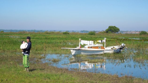
Laundry day in the swamps.
When I finally reached the cape, scores of scarlet ibises and pink flamingos took flight from a wall of iridescent green trees. Behind the cape I tied to a snag near shore. There was no real land, just sea-level swamp and mud flats. The ebbing tide laid Thurston down in bottomless muck, but by morning she had refloated. High tide at sunset is a blessing because you will have it again at dawn, when you want to leave. Low tide at sunset means you have to anchor further out, unprotected.
On my final day in the Amazon’s waning grip I rounded Cabo Orange. I stayed two miles from land but it wasn’t far enough. I kept encountering depths of only a few inches underlain by muck. The water was so muddy, and the mud so watery, there wasn’t much difference between them! These ragged capes are merely dumping grounds for the imponderable volume of silt coming out of the Amazon.
Rounding Cabo Orange I left Brazil and entered French Guiana. In a small river mouth I found the village of Ouanary. It was a speck of civilization in the jungle. From the boat landing a lane adorned with street lights and flowering shrubs ran to the high ground on which the village sat. Women in colourful, flowing garb greeted me with ‘Bon jour!’ There were no cars, just a few quads running on paved tracks.
The school teacher, a huge man with a booming laugh, sat me at his computer so I could email Ginny. “I’m okay,” I said. “I’m out of the mouth, in French Guiana. It’s really cool here!”
I washed my clothes, and spliced back together the anchor line. The teacher’s TV played the news from Paris. French Guiana is part of France just as Hawaii is part of the United States. The people spoke French Creole, and to a lesser extent French. I hiked to the top of a small mountain. The view was of endless forest.
Buy The Five Year Voyage from Amazon
Note: We may earn a commission when you buy through links on our site, at no extra cost to you. This doesn’t affect our editorial independence.
If you enjoyed this….

Yachting World is the world’s leading magazine for bluewater cruisers and offshore sailors. Every month we have inspirational adventures and practical features to help you realise your sailing dreams.Build your knowledge with a subscription delivered to your door. See our latest offers and save at least 30% off the cover price.