
If you prefer raster charts then MaxSea TimeZero app for iPad is the package for you, but perhaps not if you seek advanced features
MaxSea TimeZero – marine navigation app for iPad
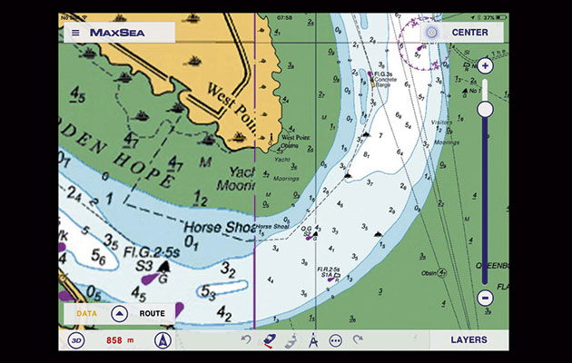
MaxSea has perfected seamless quilting of raster charts to produce a quick-to-respond, great looking chart that can be easily zoomed. Creating and editing waypoints and routes is very intuitive. Waypoint names are displayed on the chart and the entire waypoint layer can be switched off. Saved routes are indicated on the chart at start or end points by a little blue wheel icon. Once a route or waypoint is activated a data bar can be customised to show navigational data or hidden away for a full screen view.
Tidal information can be switched on or off and is represented on the chart in two layers: currents and heights. The currents appear as arrows, but there is no way to animate them over time. The weather feed requires internet access and is simply a forecast from your nearest weather station with no overlay.
If you prefer raster charts then this is the package for you, but perhaps not if you seek advanced features, focussed as it is on the core tasks of creating and navigating to routes and waypoints.
Verdict
Great for navigation planning and visual position fixing, tidal data and weather presentation is a little disappointing – if you prefer Raster charts this is the app for you.