
Wherever we have current (tidal or other) this will always influence the sailing wind and the boat’s course over the ground. At anchor we can accurately measure the wind speed…

Wherever we have current (tidal or other) this will always influence the sailing wind and the boat’s course over the ground. At anchor we can accurately measure the wind speed…
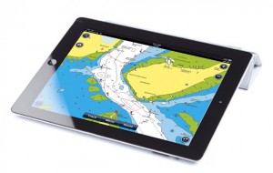
The development of navigation apps has now advanced to the stage where tablets are being used regularly by many sailors as a primary means of navigation on board. With the…

A surprisingly versatile and comprehensive app but not easy to use and contains some annoying quirks.

A good all-round package and especially versatile for ability to use raster and vector charts from multiple providers.
Good basic functionality – a full standalone navigation app – and plenty of advanced options as well, but each one incurs a fee.

Slick and well designed navigational planning app that integrates seamlessly with onboard Garmin systems

Way ahead of the competition in terms of advanced features, including augmented reality view, but not as quick for general usage. Options for Europe, Canada and USA.
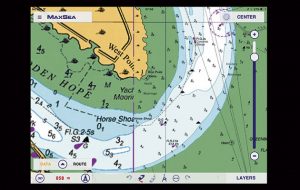
If you prefer raster charts then MaxSea TimeZero app for iPad is the package for you, but perhaps not if you seek advanced features

Pip Hare's review of the strengths and weaknesses of the Navionics and Navionics+ apps for iPad, iPhone and Android devices.

Using iPad apps for navigation is becoming a popular option and we tested seven chartplotting apps for a feature in Yachting World. But what about using an iPad on board? …

Despite being one of the major players in vector cartography, using the well-established CMaps, the Plan2Nav iPad app is old-fashioned, clunky and slow. We found it short on functions and…
Edit: Feb 2017 – This test is superseded by Garmin BlueChart test by Pip Hare. The Garmin iPad app has big clear buttons and is easy to use –…
Edit: Feb 2017 – This test is superseded by iNavX review by Pip Hare. The ability of the iNavx iPad app to read both raster scanned and vector charts makes…
Edit: Feb 2017 – This test is superseded by iSailor review by Pip Hare. iSailor iPad app has clear, easily viewed charts with optional boxes to display lat and long,…

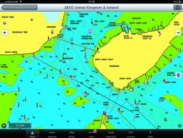
Memory Map’s UK and Ireland charts are scanned Admiralty Hydrographic charts with all their advantages, particularly for anchoring or rockhopping. Simply nothing else beats the fine detail of these…
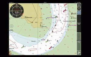
Navionics is the market leader in iPad and iPhone navigation apps. They were one of the first to launch mobile products and the apps are regularly developed and updated.

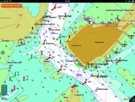
Instantly recognisable, Imray’s popular e-charts show exactly the same detail as the paper versions they have been scanned from. While this may inspire confidence in the Imray iPad app…

We've been out testing iPad charting software. Here's a first impression of the choices